Mt. Clarence King - 12,905 ft. | ||
Date: TBD | RT Distance: 33.0 miles | Elev. Gain: 9169 ft. |
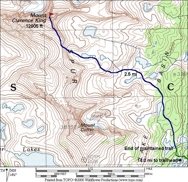
| Detail Map | Parking Map | Etymology |
|---|
Mt. Clarence King, when approached via the South Face, is mostly class 2-3 until the last couple of hundred feet. It is then class 4 to the summit block, where a few tricky moves are required to reach the pinnacle. While the summit register has numerous entries from parties that soloed the entire route, a rope is recommended for the less experienced.
| Time | Date | Names |
|---|---|---|
| 17hr30m | Bob Burd | Sept 25, 2004 |
|
|