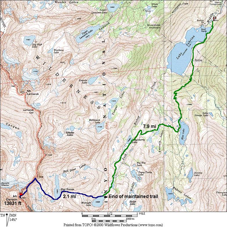
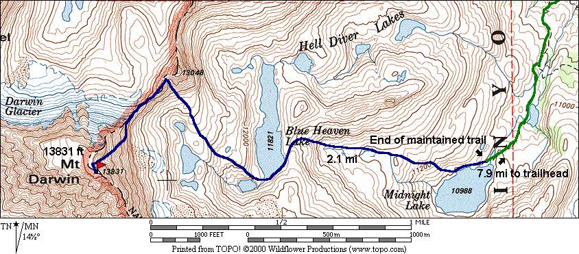
Mt. Darwin - 13,831 ft.

Thu. Aug 9, 2001 (6a start)

RT Distance: 20.0 miles

Elev. Gain: 4731 ft.

Map Detail Map Parking Map Climbing Route Etymology

The shortest approach to Mt. Darwin is via Lake Sabrina, although the routes on the east face are more difficult than the easier (but tougher approach) Darwin Glacier and West Ridge. The approach to Darwin Glacier starts at North Lake, goes through Lamark Col, and requires much cross-country and boulder hiking. There is significant loss of elevation on the west side of the col before one can begin to climb the glacier.

Camping is available at Lake Sabrina.

6a start at the trailhead.

Participants

Bob Burd

Dayhikes

TimeDateNames
13hr:30m Aug 9, 2001 Bob Burd

Multi-day Trip Reports

DateAuthor
Jun 30, 1990Patty Kline
Aug 20, 1993Barbee Tidball
Jul 2, 1994Dan Richter
Aug 18, 1996David Harris
Jul 8, 1997Jim Ramaker
DateAuthor
Jun 16, 2000Nile Sorenson
Jul 1, 2000Mike Rinaldi

For corrections or comments, or to have other trip reports for this peak referenced here, please send feedback to: snwbord@hotmail.com