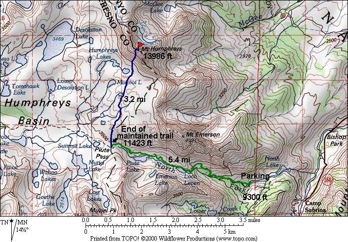
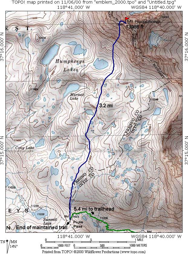
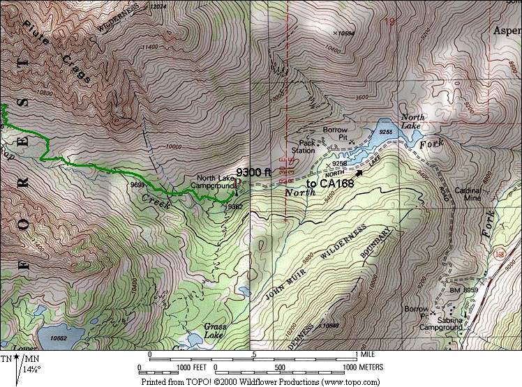
Mt. Humphreys - 13,986 ft.

Wed. Aug 8, 2001 (6a start)

RT Distance: 17.2 miles

Elev. Gain: 4686 ft.

Map Detail Map Parking Map Climbing Route Etymology

Mt. Humphreys can be approached from several trailheads. Buttermilk Road provides the shortest approach, but requires about an hour of arduous 4WD navigation. The second approach is via North Lake, easily accessible by 2WD vehicles. The North Lake trailhead provides access via Piute Pass to the easier SW approach of Mt. Humphreys. The elevation of the two trailheads are comparable. Camping is available at North Lake.

6a start at the trailhead.

Participants

Bob Burd

Dayhikes

TimeDateNames
9hr40m Aug 8, 2001 Bob Burd
12hr45m Oct 4, 1997 Tina Stough et. al.
13hr45m Oct 6, 2001 Mike McDermitt, Doug Mantle

Multi-day Trip Reports

DateAuthor
August, 1927Norman Clyde
Jul 31, 1993Dan Richter
Sep 2, 1995John Dodds
Jul 20, 1997Tony Cruz
Aug 3, 1997Butch Suits
DateAuthor
Aug 1, 1998Arun Mahajan
Aug 12, 1999Robert Walton
Sep 26, 1999Michael Gordon
Jul 23, 2000Beth Epstein
October, 199?Barbee Tidball

For corrections or comments, or to have other trip reports for this peak referenced here, please send feedback to: snwbord@hotmail.com