Matterhorn Peak - 12,327 ft. | ||
Sat. Aug 4, 2001 (6a start) | RT Distance: 11.0 miles | Elev. Gain: 5187 ft. |
| Map | Detail Map | Parking Map | Climbing Route | Etymology |
|---|
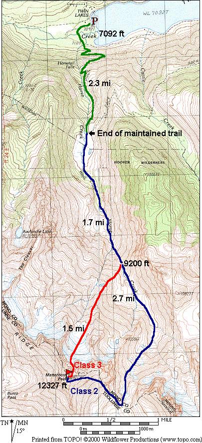
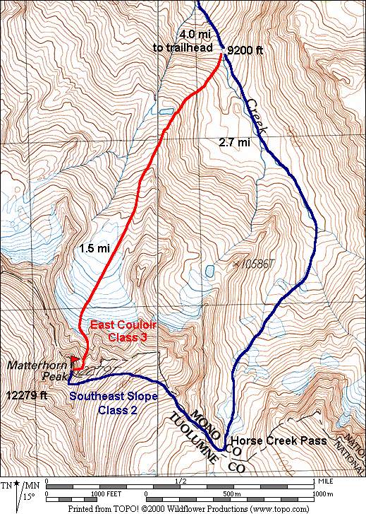
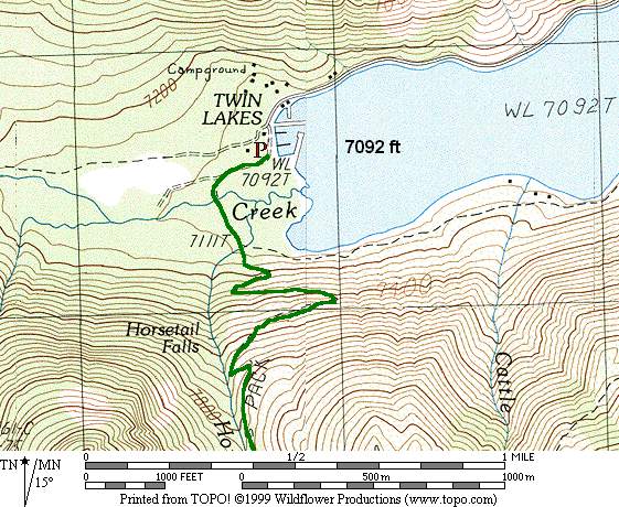
The first 2.2 miles follows the trail up Horse Creek. Where it turns to leave Horse Creek, follow a use path to the south. This trail splits in a number of places and is easy to lose along the way. Crampons and axe should be used in the class 3 couloir if you plan to take the shorter route. These are not required on the class 2 route unless the snow is hard on the north side of Horse Creek Pass.
6a start from the parking lot (trailhead is hard to find).
| Bob Burd |
| David Wright |
| Time | Date | Names |
|---|---|---|
| 9hr | Oct 10, 2004 | Harry Langenbacher |
| 9hr:15m | Aug 4, 2001 | Bob Burd, David Wright |
| 12hr:15m | August 20, 2000 | Mike McDermitt |
|
|
|