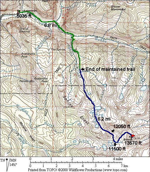
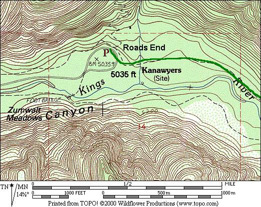
The easiest access to Mt. Brewer is via Roads End in Kings Canyon, NP. The problem with this
trailhead is that the elevation is barely above 5,000 ft, requiring 9,600+ ft of climbing. If
you think an approach via Onion Valley might be easier, I measured the total roundtrip elevation
gain to be well in excess of 10,000 ft, and more miles to boot. From Roads End, one can
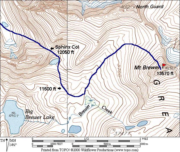
approach the peak from the east via East Lake, of from the West through Sphinx Col. The Sphinx
Col route is shorter, although there is more cross-country travel, and some elevation loss
going over Sphinx Col.