|
|
Sun. Aug 5, 2001 (5a start)
| RT Distance: 27.0 miles
| Elev. Gain: 4414
ft.
|
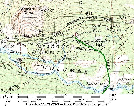
The trailhead for Mt. Lyell is in Tuolumne Meadows. One could start from a dozen locations
that are within a mile of the area, but the closest one is probably near the parking lot
on the road between the Wilderness permit office and the Tuolumne Lodge. There are plenty
of parking spaces there, and bear boxes as well. Overnight parking is unlimited and free.
The trailhead is poorly marked, but not difficult to find. Just head south from the parking
lot, cross the road, and follow a use path that shortly meets with the main trail.
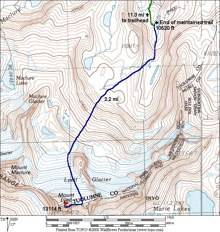
The route follows the JMT for just over 11 miles until shortly before Donohue Pass.
There are several routes to the summit, the easiest depending on snow conditions. The Lyell
glacier is split in two halves by a prominent buttress. Head for the lower, flat portion of
this buttress and cross over to the western side. The shortest route to the summit is
probably up the left side of this half of the glacier, heading towards the east arete. The
route up from the Lyell-Maclure col is easier under some conditions, but longer. Crampons and
axe are recommended.
5a start at the trailhead from the parkinglot. Note this is not the parking lot near
120 with the Wilderness Permit building, but the one a short distance down the road to
the Tuolumne Lodge - there are ample bear boxes around it (don't park at the Tuolumne
Lodge, either).
Participants
Dayhikes
Multi-day Trip Reports
For corrections or comments, or to have other trip reports for this peak referenced here,
please send feedback to: snwbord@hotmail.com