|
|
Mon. Aug 6, 2001 (6a start)
| RT Distance: 18.0 miles
| Elev. Gain: 5283
ft.
|
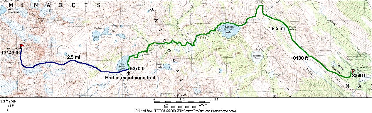
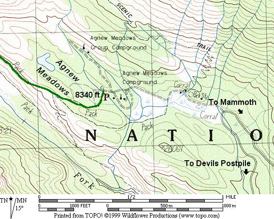
The trailhead for Mt. Ritter is located at Agnews Meadow, a short distance off CA203.
This road has restricted access, as it is very narrow, one-lane in many places, yet quite
popular. By car you can enter before 7:30a or after 5:30p. During other daylight times you
must take the shuttle bus. Once your car is inside, you can leave at anytime. Check with
the Park Service if you need more information.
For a dayhike this restriction is not usually problematic, as you are likely to want an
early start anyways. There is a NP fee (per vehicle) for entering the Devils Postpile area.
Camping is available at Agnews Meadows and other locations inside Devils Postpile NM, but
reservations are highly recommended in summer. There are several trailheads you can use
that all lead to the main trail, off to the west.
The first few miles head downhill until you cross the Middle Fork of the San Joaquin. You
will enjoy this uphill section on the return at the end of the day. :)
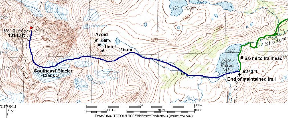
The Southeast Glacier is not usually difficult to climb, although ice axe and crampons are
recommended. Access to the glacier is slightly tricky.
If you follow the confusing description provided by Secor, you may have difficult
route-finding. This route goes up through the section marked "Cliffs" on the detail map.
The easiest route follows up the left (east) side of these cliffs where the climbing is
all class 2-3. Once you reach the glacier in the upper reaches, you can choose to climb on
the glacier itself or the rock along the right edge, depending on your preference.
6a start from the trailhead at Agnews Meadow parking lot.
Participants
Dayhikes
Multi-day Trip Reports
For corrections or comments, or to have other trip reports for this peak referenced here,
please send feedback to: snwbord@hotmail.com